The reports cover the cessation of the rainy season and the onset of the irrigated season. The dominant agricultural activities during this season were the harvesting of field crops (May-July) and the planting of winter wheat (April-May) and horticultural crops. Observed rainfall showed a 24% positive departure from the 15YA, temperature (TEMP) departure was negligible, radiation (RADPAR) showed a negative anomaly (-1%) and potential biomass production (BIOMSS) showed a positive departure by 3%. The cropped arable land fraction (CALF) showed a 2% increase and maximum VCI value was 0.96. The observed average agronomic indicators indicate favorable overall crop growth condition. Cereal supplies in the 2021/22 are estimated to exceed the five‑year average on account of the near-record harvest in 2021 with domestic supplies of maize, the primary staple food, sufficient to satisfy domestic utilization and to allow the country to build stocks and increase exports.
Regional Analysis
Regional analysis considers four main crop production zones in Zambia, namely the Northern high rainfall zone, Central-eastern and southern plateau, Western semi-arid plain and Luangwa Zambezi rift valley. In the Northern high rainfall zone, rainfall had increased by 13% above the 15YA, temperature was near average (-0.1°C), while the radiation increased by 2% leading to a 3% increase in potential biomass production. The observed cropped arable land fraction (CALF) was at 99.8% with a positive departure of 0.3% from the 5YA and VCIx was at 0.95. The Central-eastern and southern plateau, the zone where most agriculture production takes place in the country, received 58% more rainfall than the 15YA, resulting in increased biomass production (+7%), positive CALF departure (+2.2%) and VCIx of 0.99. The Western semi-arid plain received below-average rainfall (-28%) which could have resulted in reduced biomass production (-5%) as the zone has predominantly sandy soils characterized by low water holding capacity to support plant growth. The Luangwa-Zambezi Rift Valley had a positive departure in rainfall (+22%) and temperature (+0.1%) and a negative departure in radiation (-3%) and biomass (-1%). The CALF was at 99.8% (+4.5%) and VCIx of 0.94. This region is associated with low rainfall and normally affected by drought and dry spells.
Figure 3.47 Zambia’s crop condition, April- July 2022
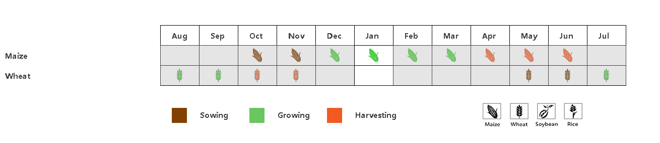
Figure A: Crop Phenology
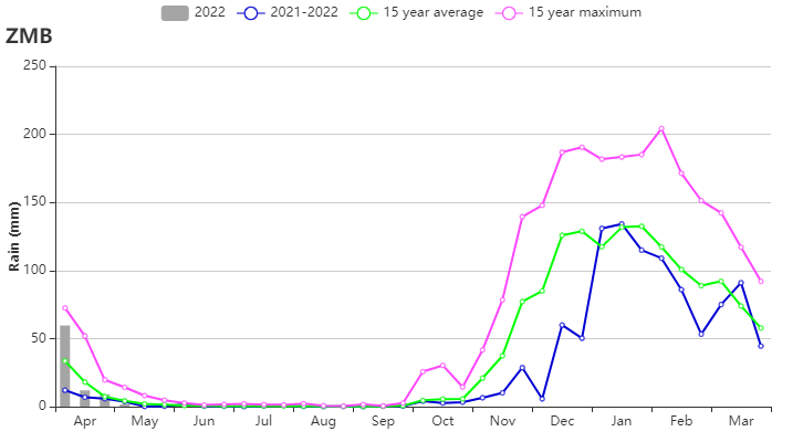
Figure B: Time series rainfall profile
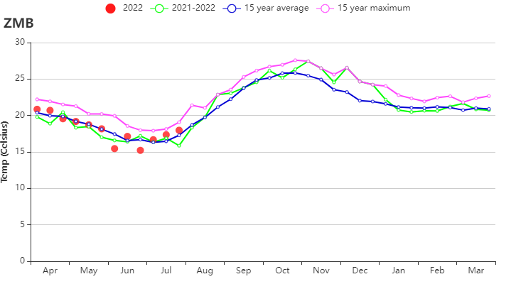
Figure C: Time series temperature profile

Figure D: Maximum VCI
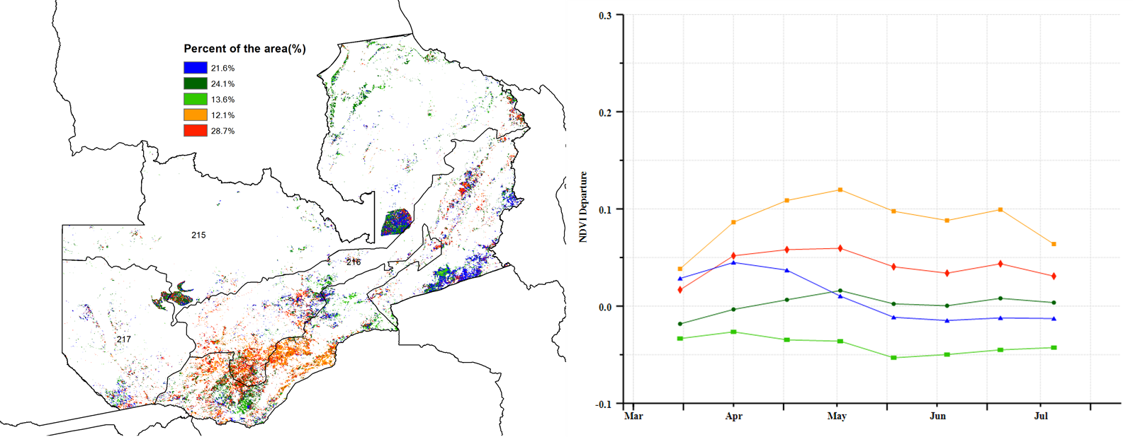
Figure E: Spatial distribution of NDVI profiles

Figure F: Crop condition development graph based on NDVI
Table 3.84 Zambia’s agroclimatic indicators by sub-national regions, current season’s values and departure from 15YA, April - July 2022
Region | RAIN | TEMP | RADPAR | BIOMSS | |||||
Current (mm) | Departure (%) | Current (°C) | Departure (°C) | Current (MJ/m2) | Departure (%) | Current (gDM/m2) | Departure (%) | ||
Luangwa-Zambezi rift valley | 48.1 | 22 | 18.2 | 0.1 | 1082 | -3 | 339 | -1 | |
Western semi-arid plain | 25.5 | -28 | 18.8 | 0.2 | 1122 | -5 | 331 | -5 | |
Central-eastern and southern plateau | 90 | 58 | 17.9 | -0.1 | 1086 | -1 | 393 | 7 | |
Northern high rainfall zone | 118.6 | 13 | 17.9 | -0.1 | 1193 | 2 | 457 | 3 | |
Table 3.85 Zambia’s agronomic indicators by sub-national regions, current season’s values and departure from 5YA, April-July 2022
Region | Cropped arable land fraction | Maximum VCI | |
Current (%) | Departure (%) | Current | |
Luangwa-Zambezi rift valley | 99.8 | 4.5 | 0.94 |
Western semi-arid plain | 99.7 | 0.7 | 0.97 |
Central-eastern and southern plateau | 99.9 | 2.2 | 0.99 |
Northern high rainfall zone | 99.8 | 0.3 | 0.95 |